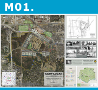
M01. Camp Logan World War 1 by
Harris County Flood Control District, Richard Rogers. [
map ]
© 2014 copyright, Harris County Flood Control District.
Special Recognition (Runner up)
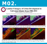
M02. Landsat 5 Imagery of Urban Dev't in Galveston Island, TX by
TSU, Mahsa Esmaeili. [
map ]
© 2014 copyright, TSU, Mahsa Esmaeili.
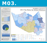
M03. 2013 Tax Rates by School Districts by
HCAD, Karen Terry. [
map ]
© 2014 copyright, HCAD.
Third Place (Tie): BEST IN CARTOGRAPHIC DESIGN
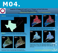
M04. Analysis of Temporal Land Cover Changes in East Galveston by
TSU, Sedigheh Heydari. [
map ]
© 2014 copyright, TSU, Sedigheh Heydari.
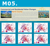
M05. Commercial and Residential Value Changes by
HCAD, Karen Terry. [
map ]
© 2014 copyright, HCAD.
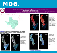
M06. Land Use and Land Cover Changes in North Galveston Bay by
TSU, Hoda Eltayeb. [
map ]
© 2014 copyright, TSU, Hoda Eltayeb.
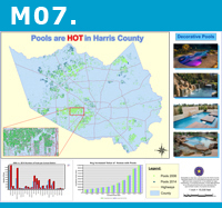
M07. Pools are HOT in Harris County by
HCAD, Karen Terry. [
map ]
© 2014 copyright, HCAD.
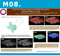
M08. Land Cover Change Analysis of the Buffalo San Jacincto by
TSU, Fatimah Alhassan. [
map ]
© 2014 copyright, TSU, Fatimah Alhassan.
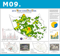
M09. 2014 New Construction (Residential and Commercial) by
HCAD, Karen Terry. [
map ]
© 2014 copyright, HCAD.
Special Recognition (Runner up)
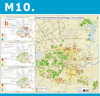
M10. Single Family Residential Housing Changes in City of Houston by
COH-PD, Sona Zechariah. [
map ]
© 2014 copyright, COH-PD.
First Place: BEST IN CARTOGRAPHIC DESIGN
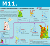
M11. Geospatial Approach to Estimate E. Coli Loadings by
HGAC, Tushara Ranatunga. [
map ]
© 2014 copyright, HGAC.
Second Place: BEST IN CONTENT & ANALYTICAL PRESENTATION
Third Place (Tie): BEST IN CARTOGRAPHIC DESIGN
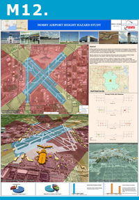
M12. Hobby Airport Height Hazard Study by
ASIS, Shibbir Ahmed. [
map ]
© 2014 copyright, ASIS.
Special Recognition (Runner up)
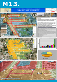
M13. Bush Intercontinental Airport Wildlife_Flight Impact Study by
ASIS, Jose Caudillo. [
map ]
© 2014 copyright, ASIS.
Special Recognition (Runner up)
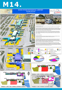
M14. Bush Intercontinental Airport Lease Study by
ASIS, Jocelyn Le. [
map ]
© 2014 copyright, ASIS.
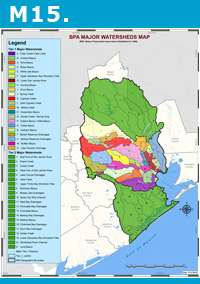
M15. BPA Major Watersheds Map by
Othon, Inc., Manik Mitra. [
map ]
© 2014 copyright, Othon, Inc.
Special Recognition (Runner up)
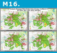
M16. Analysis Stoppage Work Orders from January 1 to March 31, Yrs 2011-2014 by
COH-PWE, Lori Kircher. [
map ]
© 2014 copyright, COH-PWE.
Special Recognition (Runner up)
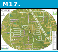
M17. Roadside Ditch/Off-Road Ditch/Outfall Assessment Project by
COH-PWE, Michelle Sparks. [
map ]
© 2014 copyright, COH-PWE.
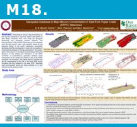
M18. Geospatial Database to Map Mercury Concentration in East Fork Poplar Creek by
TSU, Maruthi Sridhar. [
map ]
© 2014 copyright, TSU, Maruthi Sridhar.
Special Recognition (Runner up)
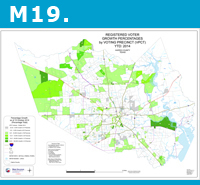
M19. Registered Voter Growth Percentages by Voting Precinct (YTD 2014) by
HCTax, Mike Catron. [
map ]
© 2014 copyright, HCTax.
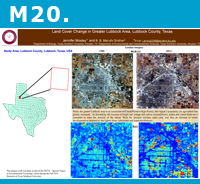
M20. Land Cover Change in Greater Lubbock County by
TSU, Jennifer Mosley. [
map ]
© 2014 copyright, TSU, Jennifer Mosley.
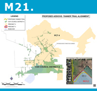
M21. Proposed Addick-Tanner Trail Alignment by
HCBMD, Amier Gantt. [
map ]
© 2014 copyright, HCBMD.
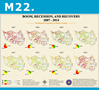
M22. Boom, Recession, and Recovery 2007-2014 by
HCAD, Karen Terry. [
map ]
© 2014 copyright, HCAD.
Third Place: BEST IN CONTENT & ANALYTICAL PRESENTATION
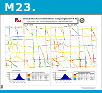
M23. Street Surface Assessment Vehicle- Comparing Runs #1 and #2 by
COH-PWE, Michelle Sparks. [
map ]
© 2014 copyright, COH-PWE.
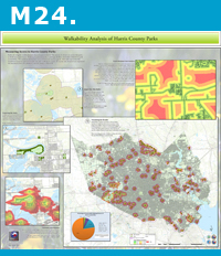
M24. Walkability Analysis of Harris County Parks by
HCITC, Johnny Brown. [
map ]
© 2014 copyright, HCITC.
First Place: BEST IN CONTENT & ANALYTICAL PRESENTATION